
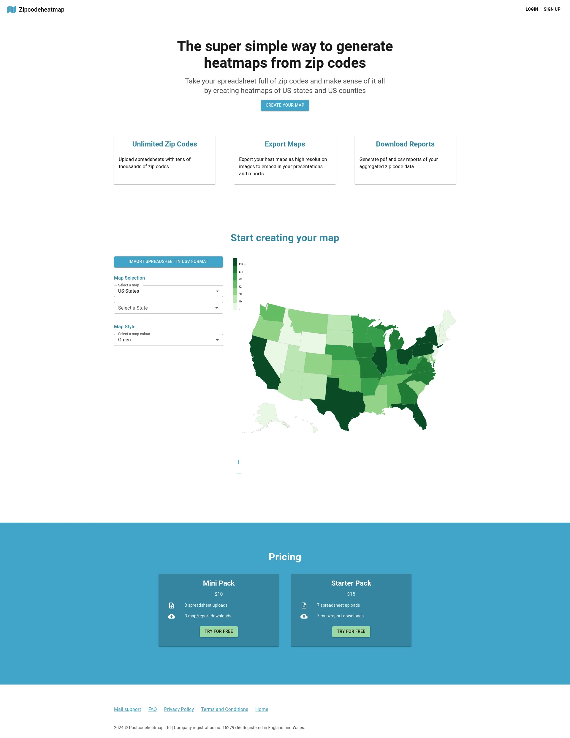
An easy to use tool that allows you to upload spreadsheets full of zip codes to create nice looking thematic maps that can visualize the density of things like sales, deliveries and real estate across US states and counties.
Our pricing plans are designed to fit various needs:
Our dedicated team of data scientists, developers, and designers work tirelessly to provide the most accurate and user-friendly heat mapping tool on the market. We are committed to helping you make data-driven decisions with ease.

Project management on a live map

Match with like-minded professionals for 1:1 conversations

Go from Slack Chaos to Clarity in Minutes

Personalize 1000s of landing pages in under 30 mins

The first LLM for document parsing with accuracy and speed

AI Assistants for SaaS professionals

AI-powered phone call app with live translation

Delightful AI-powered interactive demos—now loginless

AI Motion Graphics Copilot

Pop confetti to get rid of stress & anxiety, 100% AI-free

Smooth payments for SaaS