
Mach9 is at the forefront of leveraging advanced machine learning and computer vision techniques to transform geospatial data into actionable insights for urban development and infrastructure management. Our cutting-edge technology automates the detection and analysis of key urban features, aiding in the planning and maintenance of transportation networks.
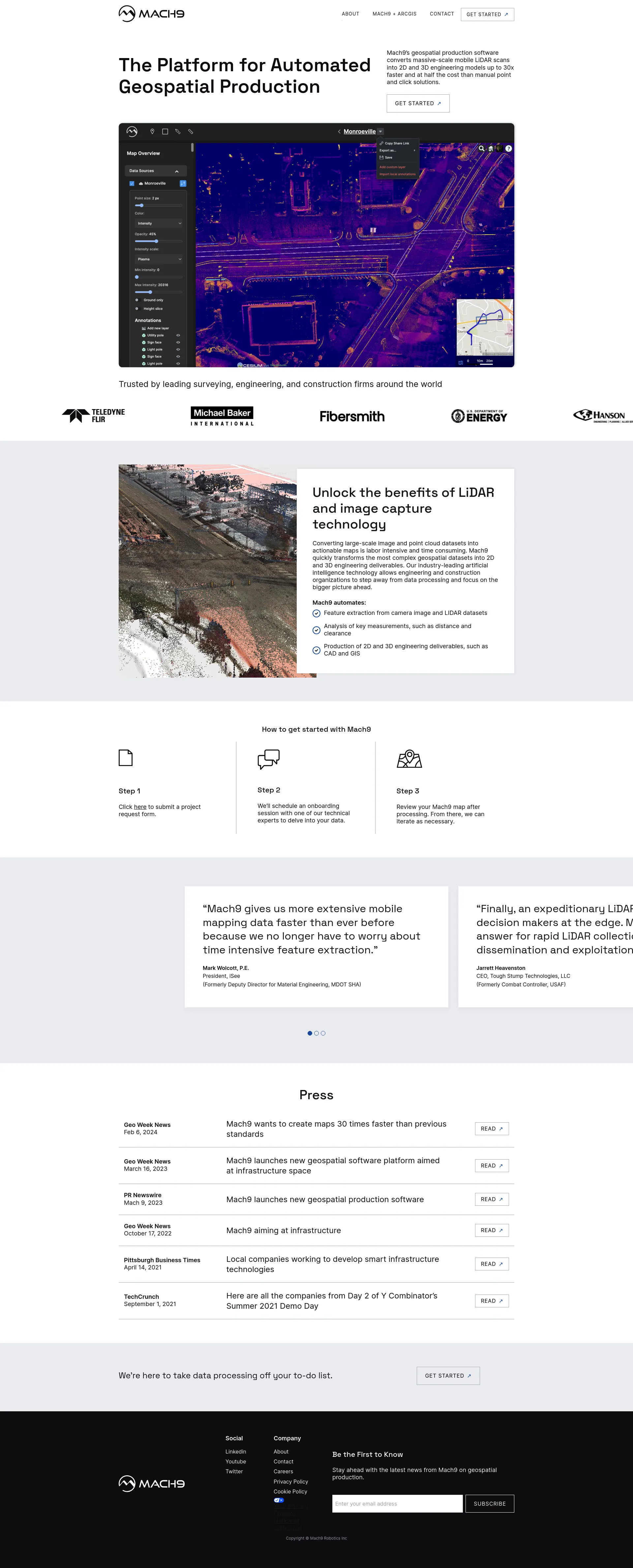
Mach9’s geospatial production software converts massive-scale mobile LiDAR scans into 2D and 3D engineering models up to 30x faster and at half the cost of manual point-and-click solutions.
Contact us to submit a project request form and schedule an onboarding session with one of our technical experts. Pricing is tailored to the specific needs and scale of your project.
Mach9 is trusted by leading surveying, engineering, and construction firms around the world. Our platform allows organizations to step away from data processing and focus on the bigger picture, leveraging industry-leading artificial intelligence technology to transform complex geospatial datasets into actionable maps.

Match with like-minded professionals for 1:1 conversations

Go from Slack Chaos to Clarity in Minutes

Personalize 1000s of landing pages in under 30 mins

The first LLM for document parsing with accuracy and speed

AI Assistants for SaaS professionals

AI-powered phone call app with live translation

Delightful AI-powered interactive demos—now loginless

AI Motion Graphics Copilot

Pop confetti to get rid of stress & anxiety, 100% AI-free

Smooth payments for SaaS
