
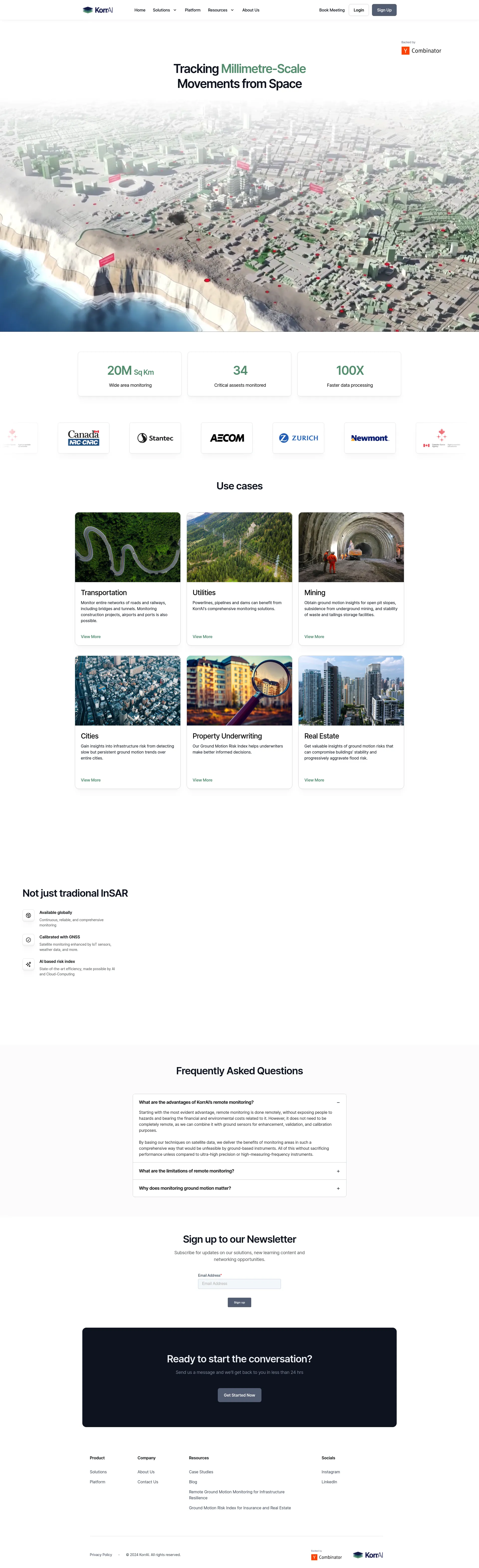
At KorrAI, we measures ground motion (land subsidence) from satellites, identifying risk before it becomes disaster. We offer fast and accurate risk maps to diverse industries, enabling smarter decisions in a changing climate.
Contact us for detailed pricing information tailored to your specific needs and use cases.
KorrAI's platform is designed with user experience in mind, making it simple and intuitive for both your team and your customers. Our solutions integrate satellite monitoring with IoT sensors, weather data, and more, ensuring comprehensive and reliable monitoring.
Match with like-minded professionals for 1:1 conversations

Go from Slack Chaos to Clarity in Minutes

Personalize 1000s of landing pages in under 30 mins

The first LLM for document parsing with accuracy and speed

AI Assistants for SaaS professionals
AI-powered phone call app with live translation

Delightful AI-powered interactive demos—now loginless

AI Motion Graphics Copilot

Pop confetti to get rid of stress & anxiety, 100% AI-free

Smooth payments for SaaS